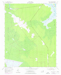
1953 Map of East Lake SE
USGS Topo · Published 1977About this map
Croatan Sound and the expanse of Roanoke Marsh define this coastal landscape on the edge of the Outer Banks. This mid-century survey, based on 1949 aerial photography and 1951 planetable data, shows a region dominated by wetlands and intricate waterways. Significant drainage and navigation features such as Billups Ditch and Hooker Gut appear alongside the winding course of Milltail Creek. The map documents a sparsely settled area where an Indefinite Boundary separates the wetlands near East Lake from the more defined tracts to the east. These 1974 revisions, shown in purple, track the development of the road network and changes in land use as the local environment was managed for conservation and transit.
Find a feature on this map
10 named features on this map. Tap any name to fly to it.
Don’t see what you’re looking for? This feature index may not catch every label — zoom into the map to look around manually.
Map Details
Editions of this 1953 East Lake SE Map
Other maps of this area

1943 · Roanoke Island
USGS Topo · 1:125,000

1953 · Wanchese
USGS Topo · 1:24,000

1953 · Engelhard NW
USGS Topo · 1:24,000

1953 · Buffalo City
USGS Topo · 1:24,000

1953 · Stumpy Point
USGS Topo · 1:24,000

1953 · Manteo
USGS Topo · 1:24,000

1953 · East Lake SE
USGS Topo · 1:24,000

1953 · Manns Harbor
USGS Topo · 1:24,000
1953 · East Lake
USGS Topo · 1:24,000

1953 · Engelhard NE
USGS Topo · 1:24,000