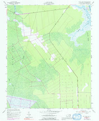
1953 Map of East Lake SE
USGS Topo · Published 1992About this map
Croatan Sound and the extensive Roanoke Marsh dominate this coastal landscape on the edge of the Albemarle Sound region. The terrain is defined by a dense network of swampy drainages and man-made alterations to the wetlands, including Fullers Ditch and the winding course of Milltail Creek. These features suggest a history of early drainage attempts and coastal navigation through the pocosin wilderness. Small inlets and tidal passages like Hooker Gut and Spencer Creek provide access points to East Lake, illustrating the isolation and water-dependent nature of this part of Dare County in the mid-20th century. Topography here is exceptionally low-lying, with numerous bench marks such as BM 3 and BM 5 tracing the few established paths through the marshy interior.
Find a feature on this map
14 named features on this map. Tap any name to fly to it.
Don’t see what you’re looking for? This feature index may not catch every label — zoom into the map to look around manually.
Map Details
Editions of this 1953 East Lake SE Map
Other maps of this area

1943 · Roanoke Island
USGS Topo · 1:125,000

1953 · Wanchese
USGS Topo · 1:24,000

1953 · Engelhard NW
USGS Topo · 1:24,000

1953 · Buffalo City
USGS Topo · 1:24,000

1953 · Stumpy Point
USGS Topo · 1:24,000

1953 · Manteo
USGS Topo · 1:24,000

1953 · East Lake SE
USGS Topo · 1:24,000

1953 · Manns Harbor
USGS Topo · 1:24,000
1953 · East Lake
USGS Topo · 1:24,000

1953 · Engelhard NE
USGS Topo · 1:24,000