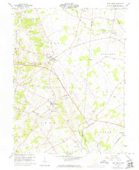
1961 Map of East Liberty
USGS Topo · Published 1974About this map
The agricultural landscape of Logan and Union Counties is defined by the headwaters of Big Darby Creek and Otter Creek during the mid-20th century. This area shows a transition in transportation infrastructure, where the Penn Central and Erie-Lackawanna railroads remained active while an Old Railroad Grade indicates a shifting rail network. The settlement of Middleburg serves as a local hub, complete with the Zane Sch and an Athletic Field, while smaller hamlets like Pottersburg and Lunda anchor the surrounding townships. Genealogists will find a high density of family and community burial sites, including the Mt Mariah Cem, Quaker Cem, and New Mill Creek Cem. Industrial activity is represented by several Sand and Gravel Pits, particularly around the creek beds, reflecting the region's geological utility.
Find a feature on this map
35 named features on this map. Tap any name to fly to it.
Don’t see what you’re looking for? This feature index may not catch every label — zoom into the map to look around manually.
Map Details
Editions of this 1961 East Liberty Map
4 editions found
Other maps of this area

1913 · East Liberty
USGS Topo · 1:62,500

1913 · Richwood
USGS Topo · 1:62,500

1914 · Mechanicsburg
USGS Topo · 1:62,500

1915 · Richwood
USGS Topo · 1:62,500

1915 · East Liberty
USGS Topo · 1:62,500

1916 · Mechanicsburg
USGS Topo · 1:62,500

1916 · Milford Center
USGS Topo · 1:62,500

1944 · East Liberty
USGS Topo · 1:62,500

1944 · Mechanicsburg
USGS Topo · 1:62,500

1944 · Richwood
USGS Topo · 1:62,500