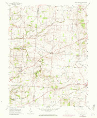
1958 Map of East Ringgold
USGS Topo · Published 1972About this map
Pickaway and Fairfield counties meet along a landscape defined by rolling agricultural drainage and early regional thoroughfares like the Ashville-Fairfield Road. This survey, updated in the early 1970s, captures a network of rural crossroads and established cemeteries that provide significant data for local genealogists, including East Union Cem and the Dutch Hollow Cem. The southeastern corner is anchored by the village of Amanda, where the Penn Central railroad cuts through the terrain near Muddy Prairie Creek.
Find a feature on this map
39 named features on this map. Tap any name to fly to it.
Don’t see what you’re looking for? This feature index may not catch every label — zoom into the map to look around manually.
Map Details
Editions of this 1958 East Ringgold Map
3 editions found
Other maps of this area

1907 · Lancaster
USGS Topo · 1:62,500

1907 · Thurston
USGS Topo · 1:62,500

1909 · Lancaster
USGS Topo · 1:62,500

1909 · Thurston
USGS Topo · 1:62,500

1914 · Circleville
USGS Topo · 1:62,500

1925 · East Columbus
USGS Topo · 1:62,500

1943 · Circleville
USGS Topo · 1:62,500

1943 · East Columbus
USGS Topo · 1:62,500

1947 · Columbus
USGS Topo · 1:250,000
1955 · Lockbourne
USGS Topo · 1:24,000