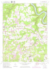
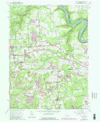
1963 Map of Eau Claire
USGS Topo · Published 1979About this map
Eau Claire and Clintonville anchor this 1963 survey of the Butler and Venango County border, a landscape defined by its extractive heritage and traditional crossroads. The terrain is deeply carved by the Allegheny River in the northeast corner and the branching waters of Scrubgrass Creek. Local history is visible in family-named settlements like Kohlmeyer Corner and Smith Corners, alongside markers of early industry such as Sutton Mill and Sedwicks Mill. The map documents a transition in energy and transport, showing extensive oil fields and pump stations interspersed with the newly constructed Interstate 80 cutting across the central hills. Cultural landmarks like Rankin Chapel and the Anderson Stone House provide specific points of interest for genealogists tracing the area's rural development through the mid-20th century.
Find a feature on this map
56 named features on this map. Tap any name to fly to it.
Don’t see what you’re looking for? This feature index may not catch every label — zoom into the map to look around manually.
Map Details
Editions of this 1963 Eau Claire Map
5 editions found
Other maps of this area

1907 · Foxburg
USGS Topo · 1:62,500

1908 · Foxburg
USGS Topo · 1:62,500

1909 · Franklin
USGS Topo · 1:62,500

1910 · Hilliards
USGS Topo · 1:62,500

1911 · Franklin
USGS Topo · 1:62,500

1912 · Hilliards
USGS Topo · 1:62,500

1922 · Oil City
USGS Topo · 1:48,000

1924 · Oil City
USGS Topo · 1:62,500

1943 · Oil City
USGS Topo · 1:62,500

1944 · Hilliards
USGS Topo · 1:62,500