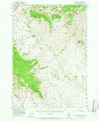
1957 Map of Edie Ranch
USGS Topo · Published 1966About this map
The Continental Divide serves as the primary geographic spine for this high-altitude borderland, separating the Beaverhead National Forest of Montana from the Targhee National Forest in Idaho. This 1957 field-checked survey highlights a remote ranching and grazing landscape where Edie Ranch sits along the upper reaches of Medicine Lodge Creek. The terrain is defined by significant summits like the Red Conglomerate Peaks and Heart Mtn, with drainage networks including Webber Creek and Crooked Creek cutting through the high country. Small-scale human activity is evidenced by an isolated Prospect and several noted springs, such as Big Spring and Warm Springs. The presence of Antelope Lakes and Hollow Lake provides water sources in an otherwise drainage-dominated landscape, which remains largely roadless except for light-duty routes like the one leading toward Bannack Pass.
Find a feature on this map
61 named features on this map. Tap any name to fly to it.
Don’t see what you’re looking for? This feature index may not catch every label — zoom into the map to look around manually.
Map Details
Editions of this 1957 Edie Ranch Map
4 editions found
Other maps of this area

1955 · Dubois
USGS Topo · 1:250,000

1957 · Paul Reservoir
USGS Topo · 1:62,500

1957 · Scott Peak
USGS Topo · 1:62,500

1957 · Edie Ranch
USGS Topo · 1:62,500

1958 · Dubois
USGS Topo · 1:250,000

1964 · Small
USGS Topo · 1:24,000

1965 · Caboose Canyon
USGS Topo · 1:24,000

1965 · Gallagher Gulch
USGS Topo · 1:24,000

1965 · Lima Peaks
USGS Topo · 1:24,000

1968 · Snowline
USGS Topo · 1:24,000