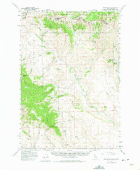
1957 Map of Edie Ranch
USGS Topo · Published 1975About this map
The Continental Divide winds through the high ridges of the Beaverhead Mountains, defining the border between Idaho and Montana. This high-altitude landscape is characterized by prominent summits such as Red Conglomerate Peaks and the massive Heart Mtn, which reaches over ten thousand feet. The transition between the Beaverhead National Forest to the north and the Targhee National Forest to the south reveals a complex drainage system, where dozens of canyons like Black Canyon and Poison Gulch feed into major watercourses.
Find a feature on this map
63 named features on this map. Tap any name to fly to it.
Don’t see what you’re looking for? This feature index may not catch every label — zoom into the map to look around manually.
Map Details
Editions of this 1957 Edie Ranch Map
4 editions found
Other maps of this area

1955 · Dubois
USGS Topo · 1:250,000

1957 · Paul Reservoir
USGS Topo · 1:62,500

1957 · Scott Peak
USGS Topo · 1:62,500

1957 · Edie Ranch
USGS Topo · 1:62,500

1958 · Dubois
USGS Topo · 1:250,000

1964 · Small
USGS Topo · 1:24,000

1965 · Caboose Canyon
USGS Topo · 1:24,000

1965 · Gallagher Gulch
USGS Topo · 1:24,000

1965 · Lima Peaks
USGS Topo · 1:24,000

1968 · Snowline
USGS Topo · 1:24,000