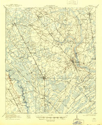
1919 Map of Egypt
USGS Topo · Published 1944About this map
Springfield and Guyton serve as the primary hubs of activity in this 1918 survey of Effingham County. The landscape is defined by the winding course of the Ogeechee River to the west and a dense network of timber-rich wetlands, including Big Bay and Duck Lake. This era shows a transition between traditional river-based transport and the growing dominance of rail lines like the Central of Georgia and Seaboard Air Line. Smaller communities like Egypt, Marlow, and Pineora are clustered along these tracks, highlighting how the railroads dictated the region's early 20th-century growth. Rural life is further mapped through scattered landmarks such as Turkey Creek Church, Shiloh School, and Cone Bridge, providing a detailed look at the social geography of the Georgia coastal plain before modern highway expansion.
Find a feature on this map
53 named features on this map. Tap any name to fly to it.
Don’t see what you’re looking for? This feature index may not catch every label — zoom into the map to look around manually.
Map Details
Editions of this 1919 Egypt Map
3 editions found
Other maps of this area

1918 · Oliver
USGS Topo · 1:62,500

1919 · Pineland
USGS Topo · 1:62,500

1919 · Shirley
USGS Topo · 1:62,500

1919 · Egypt
USGS Topo · 1:62,500

1920 · Hardeeville
USGS Topo · 1:62,500

1920 · Pembroke
USGS Topo · 1:62,500

1920 · Meldrim
USGS Topo · 1:62,500

1920 · Oliver
USGS Topo · 1:62,500

1921 · Brooklet
USGS Topo · 1:62,500

1939 · Egypt
USGS Topo · 1:62,500