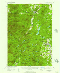
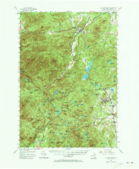
1955 Map of Elizabethtown
USGS Topo · Published 1957About this map
Elizabethtown serves as a focal point within the high peaks and river valleys of the eastern Adirondacks during the mid-1950s. The landscape is defined by the steep relief of the High Peaks region, including prominent summits like Hurricane Mtn and Giant Mtn, which drop sharply into Pleasant Valley. The economy of the era is clearly visible through the industrial activity in the eastern sector, where the iron industry shaped the development of Mineville and Witherbee. An Iron Mine and several substations underscore the area's extraction history, while numerous small cemeteries such as St Peter and Paul Cem and Black River Cem provide vital records for genealogical research. The Bouquet River and Schroon River systems anchor the drainage patterns, connecting smaller settlements like New Russia and Euba Mills through a network of valley roads and mountain passes.
Find a feature on this map
169 named features on this map. Tap any name to fly to it.
Don’t see what you’re looking for? This feature index may not catch every label — zoom into the map to look around manually.
Map Details
Editions of this 1955 Elizabethtown Map
5 editions found
Other maps of this area

1894 · Elizabethtown
USGS Topo · 1:62,500

1894 · Port Henry
USGS Topo · 1:62,500

1894 · Ticonderoga
USGS Topo · 1:62,500

1895 · Willsboro
USGS Topo · 1:62,500

1895 · Elizabethtown
USGS Topo · 1:62,500

1895 · Mt. Marcy
USGS Topo · 1:62,500

1895 · Ausable
USGS Topo · 1:62,500

1895 · Paradox Lake
USGS Topo · 1:62,500

1896 · Lake Placid
USGS Topo · 1:62,500

1896 · Ticonderoga
USGS Topo · 1:62,500