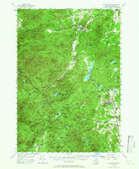
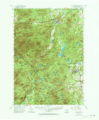
1955 Map of Elizabethtown
USGS Topo · Published 1966About this map
Elizabethtown and the surrounding high peaks are documented here in the mid-1950s, revealing a landscape defined by deep river valleys and industrial iron centers. The Bouquet River winds through Pleasant Valley, serving as the primary corridor for settlements like New Russia and Euba Mills. To the east, the intensive mining history of the region is evident at the Fisher Hill Iron Mine and the adjacent company-town clusters of Mineville and Witherbee. The terrain is marked by massive granite heights such as Giant Mtn and Hurricane Mtn, while local history is anchored by sites like Miller Cem and the Belfry Mtn Lookout Tower. This survey preserves the spatial relationship between the Adirondack wilderness and the extraction industries that shaped these Essex County communities.
Find a feature on this map
164 named features on this map. Tap any name to fly to it.
Don’t see what you’re looking for? This feature index may not catch every label — zoom into the map to look around manually.
Map Details
Editions of this 1955 Elizabethtown Map
5 editions found
Other maps of this area

1894 · Elizabethtown
USGS Topo · 1:62,500

1894 · Port Henry
USGS Topo · 1:62,500

1894 · Ticonderoga
USGS Topo · 1:62,500

1895 · Willsboro
USGS Topo · 1:62,500

1895 · Elizabethtown
USGS Topo · 1:62,500

1895 · Mt. Marcy
USGS Topo · 1:62,500

1895 · Ausable
USGS Topo · 1:62,500

1895 · Paradox Lake
USGS Topo · 1:62,500

1896 · Lake Placid
USGS Topo · 1:62,500

1896 · Ticonderoga
USGS Topo · 1:62,500