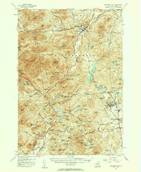
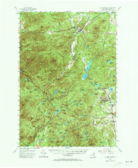
1955 Map of Elizabethtown
USGS Topo · Published 1957About this map
The Adirondack iron industry and high-peak wilderness are documented in this 1955 survey of eastern Essex County. The industrial core is centered on Witherbee, Mineville, and the Fisher Hill Iron Mine, where mining infrastructure and local substations supported the extraction of ore from the surrounding mountains. To the west, the landscape shifts toward the high wilderness of the Adirondacks, dominated by the massive profile of Giant Mtn and Rocky Peak Ridge.
Find a feature on this map
157 named features on this map. Tap any name to fly to it.
Don’t see what you’re looking for? This feature index may not catch every label — zoom into the map to look around manually.
Map Details
Editions of this 1955 Elizabethtown Map
5 editions found
Other maps of this area

1894 · Elizabethtown
USGS Topo · 1:62,500

1894 · Port Henry
USGS Topo · 1:62,500

1894 · Ticonderoga
USGS Topo · 1:62,500

1895 · Willsboro
USGS Topo · 1:62,500

1895 · Elizabethtown
USGS Topo · 1:62,500

1895 · Mt. Marcy
USGS Topo · 1:62,500

1895 · Ausable
USGS Topo · 1:62,500

1895 · Paradox Lake
USGS Topo · 1:62,500

1896 · Lake Placid
USGS Topo · 1:62,500

1896 · Ticonderoga
USGS Topo · 1:62,500