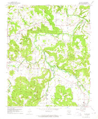
1958 Map of Elkins
USGS Topo · Published 1965About this map
White River tributaries define the rural landscape of Washington County in the late 1950s, where small settlements and family farms are anchored by local institutions. The convergence of the Middle Fork and the West Fork White River near Elkins provides a look at the region's agricultural and social hub, marked by a high density of country churches and burial grounds. Significant topographic features like Round Mountain and Robinson Mountain overlook the fertile bottoms where Wyman and Harris are located.
Find a feature on this map
37 named features on this map. Tap any name to fly to it.
Don’t see what you’re looking for? This feature index may not catch every label — zoom into the map to look around manually.
Map Details
Editions of this 1958 Elkins Map
3 editions found

Other maps of this area

1898 · Winslow
USGS Topo · 1:125,000

1899 · Fayetteville
USGS Topo · 1:125,000

1900 · Eureka Springs
USGS Topo · 1:125,000

1901 · Winslow
USGS Topo · 1:125,000

1901 · Eureka Springs
USGS Topo · 1:125,000

1901 · Fayetteville
USGS Topo · 1:125,000

1904 · Fayetteville
USGS Topo · 1:125,000

1943 · St. Paul
USGS Topo · 1:62,500

1945 · Harrison
USGS Topo · 1:250,000

1946 · St. Paul
USGS Topo · 1:62,500