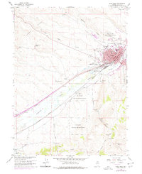
1962 Map of Elko West
USGS Topo · Published 1977About this map
Elko is the commercial and civic hub of this landscape, its grid organized around the Southern Pacific and Western Pacific railroads. The town serves as the county seat, anchored by the Courthouse and High School at its center, with the County Fairgrounds and Golf Course providing community spaces. Just to the north and south, the Elko Colony Indian Reservation and Te-Moak Indian Reservation signify the enduring presence of the Western Shoshone within the valley.
Find a feature on this map
41 named features on this map. Tap any name to fly to it.
Don’t see what you’re looking for? This feature index may not catch every label — zoom into the map to look around manually.
Map Details
Editions of this 1962 Elko West Map
Other maps of this area

1952 · Dixie Flats
USGS Topo · 1:62,500

1955 · Elko
USGS Topo · 1:250,000

1957 · Elko West
USGS Topo · 1:24,000

1957 · Elko East
USGS Topo · 1:24,000

1958 · Elko
USGS Topo · 1:250,000

1958 · Hunter
USGS Topo · 1:24,000

1958 · Doby Summit
USGS Topo · 1:24,000

1962 · Elko
USGS Topo · 1:250,000

1962 · Kittridge Springs
USGS Topo · 1:24,000

1962 · Osino
USGS Topo · 1:24,000