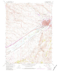
1962 Map of Elko West
USGS Topo · Published 1984About this map
The city of Elko sits at a critical junction of transport and water in this mid-century Nevada landscape. The rail corridors of the Southern Pacific and Western Pacific parallel the Humboldt River, reflecting the historical importance of this narrow valley for cross-country movement. Cultural and tribal lands are prominent, with the Elko Colony Indian Reservation adjacent to the city and the South Fork Indian Reservation further south.
Find a feature on this map
35 named features on this map. Tap any name to fly to it.
Don’t see what you’re looking for? This feature index may not catch every label — zoom into the map to look around manually.
Map Details
Editions of this 1962 Elko West Map
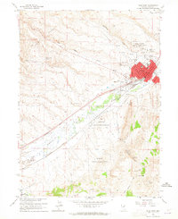
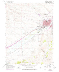
Other maps of this area

1952 · Dixie Flats
USGS Topo · 1:62,500

1955 · Elko
USGS Topo · 1:250,000

1957 · Elko West
USGS Topo · 1:24,000

1957 · Elko East
USGS Topo · 1:24,000

1958 · Elko
USGS Topo · 1:250,000

1958 · Hunter
USGS Topo · 1:24,000

1958 · Doby Summit
USGS Topo · 1:24,000

1962 · Elko
USGS Topo · 1:250,000

1962 · Kittridge Springs
USGS Topo · 1:24,000

1962 · Osino
USGS Topo · 1:24,000