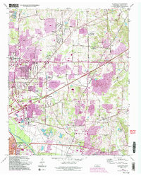
1965 Map of Ellendale
USGS Topo · Published 1993About this map
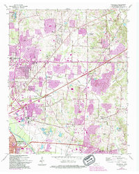
Ellendale and the surrounding Shelby County communities of Bartlett and Cordova sit at a major intersection of suburban growth and institutional presence in the mid-1960s. The landscape is defined by its educational and public works infrastructure, including the Tennessee Technical School, the Federal Correctional Center, and the extensive grounds of Shelby Farms. The southern portion of the map follows the course of the Wolf River, with residential expansion pressing toward the banks of Walnut Grove Lake. Local history and genealogy are anchored by several established sites such as Morning Chapel, New Hope Ch, and prominent memorial grounds like Memory Hill Gardens (Cemetery). The network of roads, including Raleigh Lagrange Road and Mullins Station Road, illustrates the evolving transportation corridors connecting these outlying areas to the greater Memphis area.
Find a feature on this map
60 named features on this map. Tap any name to fly to it.
Don’t see what you’re looking for? This feature index may not catch every label — zoom into the map to look around manually.
Map Details
Editions of this 1965 Ellendale Map
5 editions found
Other maps of this area

1942 · Millington
USGS Topo · 1:62,500

1943 · Collierville
USGS Topo · 1:62,500

1953 · Collierville
USGS Topo · 1:50,000

1954 · Mason
USGS Topo · 1:62,500

1956 · Blytheville
USGS Topo · 1:250,000

1959 · Blytheville
USGS Topo · 1:250,000

1960 · Bartlett
USGS Topo · 1:62,500

1960 · Millington
USGS Topo · 1:62,500

1961 · Bartlett
USGS Topo · 1:62,500
1965 · Collierville
USGS Topo · 1:24,000