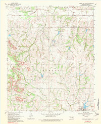
1969 Map of Elmore City North
USGS Topo · Published 1982About this map
The rolling oil fields of north-central Garvin County are captured here just before the 1970s energy boom. The landscape is dominated by the industrial infrastructure of the Lindsay Field, where a dense network of Oil Wells and a central Refinery contrast with the rural character of the Antioch community. The town of Elmore City anchors the southern edge of the map, featuring its Waterworks and municipal structures.
Find a feature on this map
27 named features on this map. Tap any name to fly to it.
Don’t see what you’re looking for? This feature index may not catch every label — zoom into the map to look around manually.
Map Details
Editions of this 1969 Elmore City North Map
2 editions found
Other maps of this area

1898 · Pauls Valley
USGS Topo · 1:125,000

1902 · Pauls Valley
USGS Topo · 1:125,000

1902 · Rush Springs
USGS Topo · 1:125,000

1957 · Ardmore
USGS Topo · 1:250,000

1963 · Ardmore
USGS Topo · 1:250,000

1965 · Maysville
USGS Topo · 1:24,000

1965 · Paoli
USGS Topo · 1:24,000

1966 · Lindsay
USGS Topo · 1:24,000

1969 · Hennepin
USGS Topo · 1:24,000
1969 · Elmore City NE
USGS Topo · 1:24,000