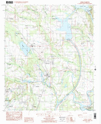
1987 Map of Elmore
USGS Topo · Published 1987About this map
The Coosa River dominates this portion of Elmore County, winding south toward its confluence with the Tallapoosa River near the historic Fort Toulouse State Park. The landscape reflects a mix of heavy infrastructure and established rural communities, anchored by the Jordan Dam and Walter Bouldin Dam which regulate the river's flow into Jordan Lake. Rail activity is concentrated along the CSX line, connecting the settlements of Speigner, North Elmore, and Elmore.
Find a feature on this map
41 named features on this map. Tap any name to fly to it.
Don’t see what you’re looking for? This feature index may not catch every label — zoom into the map to look around manually.
Map Details
Editions of this 1987 Elmore Map
2 editions found
Other maps of this area

1901 · Wetumpka
USGS Topo · 1:125,000

1901 · Wetumpka
USGS Topo · 1:62,500

1903 · Wetumpka
USGS Topo · 1:125,000

1927 · Montgomery
USGS Topo · 1:48,000

1930 · Montgomery
USGS Topo · 1:62,500

1953 · Montgomery
USGS Topo · 1:250,000

1956 · Montgomery
USGS Topo · 1:250,000

1957 · Montgomery
USGS Topo · 1:250,000

1958 · Montgomery
USGS Topo · 1:62,500

1958 · Montgomery North
USGS Topo · 1:24,000