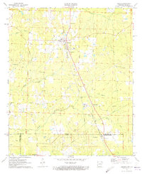
1971 Map of Emerson
USGS Topo · Published 1973About this map
Emerson sits at the heart of this early 1970s survey, marking a significant community hub where the Louisiana and North West railroad cuts a diagonal path toward the state line. The landscape transitions from the agricultural and residential clusters of Forest Grove and Millerton to the industrial infrastructure of the Horsehead Oil Field and Haynesville Oil Field. Numerous country churches and family-named cemeteries, such as Sweet Home Ch, Pleasant Home Ch, and Elliott Cem, are scattered across the terrain, reflecting the deep-rooted social and genealogical history of the Arkansas-Louisiana borderlands. The intricate drainage of Cypress Creek and its many branches like South Cypress Creek define the local topography, while numerous oil wells and drill holes illustrate the era's focus on resource extraction within the piney woods of Columbia County.
Find a feature on this map
35 named features on this map. Tap any name to fly to it.
Don’t see what you’re looking for? This feature index may not catch every label — zoom into the map to look around manually.
Map Details
Editions of this 1971 Emerson Map
2 editions found
Other maps of this area

1922 · Sarepta
USGS Topo · 1:62,500

1924 · Sarepta
USGS Topo · 1:62,500

1952 · Homer
USGS Topo · 1:62,500

1953 · El Dorado
USGS Topo · 1:250,000

1955 · Shreveport
USGS Topo · 1:250,000

1956 · Shreveport
USGS Topo · 1:250,000

1956 · Sarepta
USGS Topo · 1:62,500

1957 · El Dorado
USGS Topo · 1:250,000

1958 · El Dorado
USGS Topo · 1:250,000

1960 · El Dorado
USGS Topo · 1:250,000