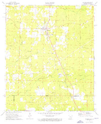
1971 Map of Emerson
USGS Topo · Published 1976About this map
The town of Emerson sits at the center of this topographic study, serving as a hub for the agricultural and petroleum-rich lands straddling the border between Columbia County, Arkansas, and Louisiana. The local economy is defined by industrial extraction, with the Horsehead Oil Field and Haynesville Oil Field dominating the landscape with numerous oil wells and drill holes. The Louisiana and North West RR provides a critical transportation spine through the region, passing directly through the heart of the settlement.
Find a feature on this map
31 named features on this map. Tap any name to fly to it.
Don’t see what you’re looking for? This feature index may not catch every label — zoom into the map to look around manually.
Map Details
Editions of this 1971 Emerson Map
2 editions found
Other maps of this area

1922 · Sarepta
USGS Topo · 1:62,500

1924 · Sarepta
USGS Topo · 1:62,500

1952 · Homer
USGS Topo · 1:62,500

1953 · El Dorado
USGS Topo · 1:250,000

1955 · Shreveport
USGS Topo · 1:250,000

1956 · Shreveport
USGS Topo · 1:250,000

1956 · Sarepta
USGS Topo · 1:62,500

1957 · El Dorado
USGS Topo · 1:250,000

1958 · El Dorado
USGS Topo · 1:250,000

1960 · El Dorado
USGS Topo · 1:250,000