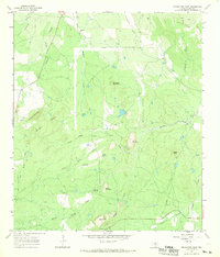
1967 Map of Enchanted Rock
USGS Topo · Published 1969About this map
Enchanted Rock dominates the southern landscape of this Central Texas survey, surrounded by a complex network of granite peaks and spring-fed drainages. The topography is defined by prominent elevations like Bullhead Mountain, Dutch Mountain, and Watch Mountain, which create a rugged backdrop for the ranching and resource extraction of the late 1960s. Signs of local industry are evident in several Prospect and Quarry locations, while names like Goldmine Creek and Silvermine Creek hint at the mineral-rich history of the Llano Uplift.
Find a feature on this map
32 named features on this map. Tap any name to fly to it.
Don’t see what you’re looking for? This feature index may not catch every label — zoom into the map to look around manually.
Map Details
Editions of this 1967 Enchanted Rock Map
2 editions found
Other maps of this area

1887 · Llano
USGS Topo · 1:125,000

1894 · Fredericksburg
USGS Topo · 1:125,000

1894 · Llano
USGS Topo · 1:125,000

1904 · Llano
USGS Topo · 1:125,000

1909 · Llano
USGS Topo · 1:125,000

1918 · Llano
USGS Topo · 1:125,000

1954 · Llano
USGS Topo · 1:250,000

1955 · Llano
USGS Topo · 1:250,000

1956 · Llano
USGS Topo · 1:250,000
1960 · Scotts Crossing
USGS Topo · 1:24,000