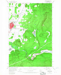
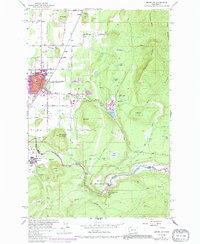
1956 Map of Enumclaw
USGS Topo · Published 1967About this map
The Northern Pacific railroad corridor serves as the primary artery for Enumclaw, connecting the growing town to the timber and agricultural lands of south King County. At the foot of Boise Ridge, the landscape transitions from the grid of city streets like 440th Street to the active industry of the Upper Mill and its associated Millpond. The timber economy is further evidenced by a network of logging roads and numerous reservoirs like First Lake and Second Lake that supported operations near the hills.
Find a feature on this map
58 named features on this map. Tap any name to fly to it.
Don’t see what you’re looking for? This feature index may not catch every label — zoom into the map to look around manually.
Map Details
Editions of this 1956 Enumclaw Map
5 editions found
Other maps of this area

1897 · Tacoma
USGS Topo · 1:125,000

1900 · Tacoma
USGS Topo · 1:125,000

1913 · Cedar Lake
USGS Topo · 1:125,000

1942 · Lake Tapps
USGS Topo · 1:62,500

1944 · Lake Tapps
USGS Topo · 1:62,500

1949 · Black Diamond
USGS Topo · 1:24,000

1953 · Eagle Gorge
USGS Topo · 1:24,000

1953 · Cumberland
USGS Topo · 1:24,000
1956 · Buckley
USGS Topo · 1:24,000
1956 · Wilkeson
USGS Topo · 1:24,000