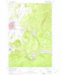
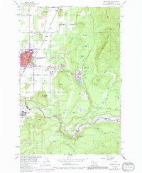
1956 Map of Enumclaw
USGS Topo · Published 1976About this map
Enumclaw and its surrounding dairy and timber landscapes are captured during a period of transition, with purple-tinted revisions showing mid-1970s urban growth over a 1956 topographical base. The town serves as a hub between the plateau's agricultural lands and the rising Cascades, centered on the Burlington Northern rail line and the local educational anchor, Byron Kibler School. To the east, the timber economy is evident at the Upper Mill and its associated Millpond, while the White River canyon to the south is dominated by the massive flood control infrastructure of the Mud Mtn Dam Spillway and Mud Mountain Lake. The map reveals a mix of family-named heights like Stanridge Hill and Baldy Hill alongside social fixtures of the era, including a Drive-in Theater and the expansive grounds of the Rainier State School.
Find a feature on this map
53 named features on this map. Tap any name to fly to it.
Don’t see what you’re looking for? This feature index may not catch every label — zoom into the map to look around manually.
Map Details
Editions of this 1956 Enumclaw Map
5 editions found
Other maps of this area

1897 · Tacoma
USGS Topo · 1:125,000

1900 · Tacoma
USGS Topo · 1:125,000

1913 · Cedar Lake
USGS Topo · 1:125,000

1942 · Lake Tapps
USGS Topo · 1:62,500

1944 · Lake Tapps
USGS Topo · 1:62,500

1949 · Black Diamond
USGS Topo · 1:24,000

1953 · Eagle Gorge
USGS Topo · 1:24,000

1953 · Cumberland
USGS Topo · 1:24,000
1956 · Buckley
USGS Topo · 1:24,000
1956 · Wilkeson
USGS Topo · 1:24,000