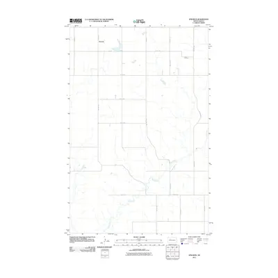
2011 Map of Epworth
USGS Topo · Published 2011About this map
The settlement of Epworth anchors this section of Mountrail County, sitting amidst a systematic grid of section roads during the early 21st century. The landscape is defined by the winding course of Shell Creek, which meanders through the southern and eastern portions of the quadrangle, contrasting with the rigid geometry of the surrounding agricultural land. Genealogists and local historians will find Johns Cemetery in the northeastern corner, a significant landmark for tracing family roots in this rural community. The map details an extensive network of local thoroughfares, including 48th St NW and 75 Ave NW, which facilitated movement across this North Dakota prairie. Small ponds and localized depressions are scattered throughout, typical of the regional topography and providing drainage toward the creek basin.
Find a feature on this map
21 named features on this map. Tap any name to fly to it.
Don’t see what you’re looking for? This feature index may not catch every label — zoom into the map to look around manually.
Map Details
Editions of this 2011 Epworth Map
This is the sole edition of this map. No revisions or reprints were ever made.
Other maps of this area

1953 · Williston
USGS Topo · 1:250,000

1953 · Watford City
USGS Topo · 1:250,000

1957 · Williston
USGS Topo · 1:250,000

1957 · Watford City
USGS Topo · 1:250,000

1967 · Watford City
USGS Topo · 1:250,000
1981 · Parshall NE
USGS Topo · 1:24,000
1981 · Epworth SE
USGS Topo · 1:24,000
1981 · Belden SE
USGS Topo · 1:24,000
1981 · Shell Lake
USGS Topo · 1:24,000
1981 · Parshall
USGS Topo · 1:24,000