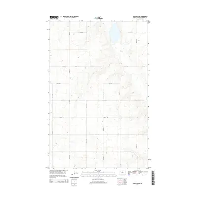
2014 Map of Epworth NW
USGS Topo · Published 2014About this map
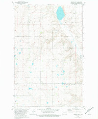
The rolling plains of Mountrail County are defined by a rhythmic grid of rural section roads and the meandering path of Shell Cr in this 2014 topographic study. Situated south of the Missouri River plateau, the landscape is almost entirely dedicated to agriculture, punctuated only by small depressions and the drainage of the creek as it flows through the eastern portion of the quadrangle. A significant landmark for local genealogy is the Epworth Cem, located in the southern section of the map. The road network, including thoroughfares such as Palermo Rd, 57th St NW, and 50th St NW, illustrates the enduring structure of North Dakota's homestead-era land divisions. This map provides a clear view of the high-plains geography and the sparse, purposeful placement of human markers like the cemetery against a vast open landscape.
Find a feature on this map
17 named features on this map. Tap any name to fly to it.
Don’t see what you’re looking for? This feature index may not catch every label — zoom into the map to look around manually.
Map Details
Editions of this 2014 Epworth NW Map
This is the sole edition of this map. No revisions or reprints were ever made.
Other maps of this area

1953 · Williston
USGS Topo · 1:250,000

1957 · Williston
USGS Topo · 1:250,000
1969 · Stanley SE
USGS Topo · 1:24,000
1981 · Epworth SE
USGS Topo · 1:24,000
1981 · Belden SE
USGS Topo · 1:24,000
1981 · Stanley SE
USGS Topo · 1:24,000
1981 · Palermo
USGS Topo · 1:24,000
1981 · Shell Lake
USGS Topo · 1:24,000
1981 · Epworth
USGS Topo · 1:24,000
1981 · Epworth NW
USGS Topo · 1:24,000