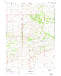
1963 Map of Erickson-Kent Ranch
USGS Topo · Published 1978About this map
East Salt Wells Creek carves a central path through this high-desert landscape in Sweetwater County, defining the primary drainage for the surrounding basins. The Erickson-Kent Ranch stands as the principal named habitation, located near the confluence of several seasonal washes including East Draw. This 1963 survey (with 1970s revisions) illustrates a landscape dominated by topographic relief and water management in an arid environment, where features like Brooks Well and various windmills were critical for livestock and land use. The southern portion of the map is dramatically defined by the rising escarpment of Rifes Rim, which towers over the drainage system. The complex network of seasonal watercourses, including West Draw and Brooks Draw, highlights the erosional patterns and the isolation of the high plateau country during this era.
Find a feature on this map
10 named features on this map. Tap any name to fly to it.
Don’t see what you’re looking for? This feature index may not catch every label — zoom into the map to look around manually.
Map Details
Editions of this 1963 Erickson-Kent Ranch Map
2 editions found
Other maps of this area

1954 · Rock Springs
USGS Topo · 1:250,000

1958 · Rock Springs
USGS Topo · 1:250,000

1962 · Rock Springs
USGS Topo · 1:250,000

1963 · Four J Rim
USGS Topo · 1:24,000
1963 · Potter Mountain
USGS Topo · 1:24,000

1963 · Erickson-Kent Ranch
USGS Topo · 1:24,000

1963 · Scrivner Butte
USGS Topo · 1:24,000
1968 · Chicken Creek SW
USGS Topo · 1:24,000

1968 · Mud Springs Ranch
USGS Topo · 1:24,000

1968 · Pine Butte
USGS Topo · 1:24,000