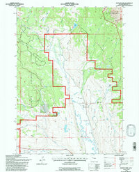
1991 Map of Esmond Park
USGS Topo · Published 1997About this map
Shoshone National Forest defines the upper reaches of the Wind River valley on this 1991 revision, where the landscape is carved by the DuNoir Creek drainage. The map reveals a transition from the protected high country of the Washakie Wilderness in the north to the ranching-and-river economy along the Wind River to the south. Private inholdings and active land use are concentrated along the creek bottoms, marked by family and commercial holdings such as the Ramshorn Guest Ranch, Highland Meadow Ranch, and Glade Ranch.
Find a feature on this map
32 named features on this map. Tap any name to fly to it.
Don’t see what you’re looking for? This feature index may not catch every label — zoom into the map to look around manually.
Map Details
Editions of this 1991 Esmond Park Map
This is the sole edition of this map. No revisions or reprints were ever made.
Other maps of this area

1905 · Younts Peak
USGS Topo · 1:125,000

1907 · Younts Peak
USGS Topo · 1:125,000

1955 · Thermopolis
USGS Topo · 1:250,000

1956 · Dubois
USGS Topo · 1:24,000

1956 · Esmond Park
USGS Topo · 1:24,000

1956 · Shoshone Pass
USGS Topo · 1:24,000

1956 · Ramshorn Peak
USGS Topo · 1:24,000

1956 · Warm Spring Mountain
USGS Topo · 1:24,000

1956 · Five Pockets
USGS Topo · 1:24,000

1956 · Fish Lake
USGS Topo · 1:24,000