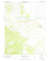
1959 Map of Esparto
USGS Topo · Published 1974About this map
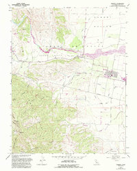
Cache Creek defines the transition between the rolling hills and the fertile agricultural flats of the western Sacramento Valley during the late 1950s. The settlement of Esparto serves as a local hub, anchored by the Southern Pacific railroad line and a local High School. This area shows a complex system of water management essential for valley farming, with the Adams Canal, West Adams Canal, and Winters Canal branching off the creek to irrigate the Cañada de Capay.
Find a feature on this map
40 named features on this map. Tap any name to fly to it.
Don’t see what you’re looking for? This feature index may not catch every label — zoom into the map to look around manually.
Map Details
Editions of this 1959 Esparto Map
5 editions found
Other maps of this area

1905 · Esparto
USGS Topo · 1:24,000

1907 · Dunnigan
USGS Topo · 1:62,500

1907 · Woodland
USGS Topo · 1:62,500

1916 · Jacobs Corner
USGS Topo · 1:31,680

1916 · Zamora
USGS Topo · 1:31,680

1916 · Winters
USGS Topo · 1:31,680

1916 · Esparto
USGS Topo · 1:31,680

1924 · Capay
USGS Topo · 1:62,500
1941 · Dunnigan
USGS Topo · 1:62,500
1941 · Woodland
USGS Topo · 1:62,500