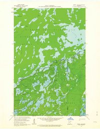
1959 Map of Ester Lake
USGS Topo · Published 1964About this map
Quetico Provincial Park and the Superior National Forest meet along the international boundary in this 1959 field-checked survey. The landscape is dominated by a complex network of glacial lakes and waterways, including the expansive Saganaga Lake and Cypress Lake. The map reveals the intricate border topography where Hunter Island sits across from the American shore, separated by narrow channels and rapids such as High Falls. A genuine insight into the region's wilderness character is found in the naming of remote water bodies like Lake of the Clouds, Ester Lake, and Mist Lake, which are linked by portages and swampy passages rather than roads. This survey, published in the mid-1960s, serves as a detailed guide to the hydrological connections of the Boundary Waters, showing the transition from Cache Bay into the deeper interior of the northern woods.
Find a feature on this map
57 named features on this map. Tap any name to fly to it.
Don’t see what you’re looking for? This feature index may not catch every label — zoom into the map to look around manually.
Map Details
Editions of this 1959 Ester Lake Map
4 editions found
Other maps of this area

1957 · Quetico
USGS Topo · 1:250,000

1959 · Munker Island
USGS Topo · 1:24,000

1959 · Ogishkemuncie Lake
USGS Topo · 1:24,000

1959 · Kekekabic Lake
USGS Topo · 1:24,000

1959 · Dutton Lake
USGS Topo · 1:24,000

1959 · Gillis Lake
USGS Topo · 1:24,000

1959 · Ester Lake
USGS Topo · 1:24,000

1968 · Quetico
USGS Topo · 1:250,000

1976 · Saganaga Lake
USGS Topo · 1:100,000

1977 · Basswood Lake
USGS Topo · 1:100,000