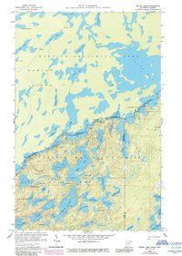
1959 Map of Ester Lake
USGS Topo · Published 1986About this map
Quetico Provincial Park and the Superior National Forest meet along a watery international border defined by ancient glacial lakes and intricate canoe routes. This mid-century survey captures the remote character of the Boundary Waters Canoe Area Wilderness before modern land-use pressures, highlighting the essential portages and water connections that have served travelers for generations. Notable landmarks like High Falls and the Swamp Portage near Mud Bay indicate the difficult but navigable path through this archipelago-filled landscape. The map details the transition from Hunter Island in Ontario to the lake-strewn interior of Minnesota, where Ester Lake, Rabbit Lake, and the poetically named Lake of the Clouds sit within a dense network of timber and granite. The presence of the Ottertrack trail reflects the historical movement through the Rainy River District along the border of Lake and Cook counties.
Find a feature on this map
61 named features on this map. Tap any name to fly to it.
Don’t see what you’re looking for? This feature index may not catch every label — zoom into the map to look around manually.
Map Details
Editions of this 1959 Ester Lake Map
4 editions found
Other maps of this area

1957 · Quetico
USGS Topo · 1:250,000

1959 · Munker Island
USGS Topo · 1:24,000

1959 · Ogishkemuncie Lake
USGS Topo · 1:24,000

1959 · Kekekabic Lake
USGS Topo · 1:24,000

1959 · Dutton Lake
USGS Topo · 1:24,000

1959 · Gillis Lake
USGS Topo · 1:24,000

1959 · Ester Lake
USGS Topo · 1:24,000

1968 · Quetico
USGS Topo · 1:250,000

1976 · Saganaga Lake
USGS Topo · 1:100,000

1977 · Basswood Lake
USGS Topo · 1:100,000