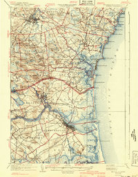
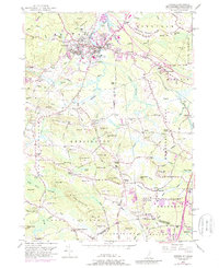
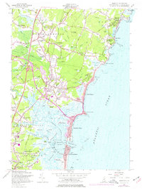
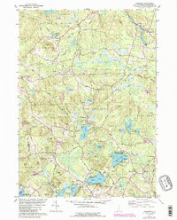
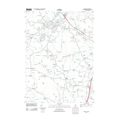
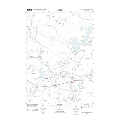
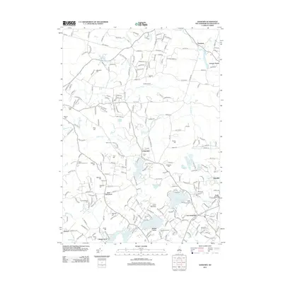
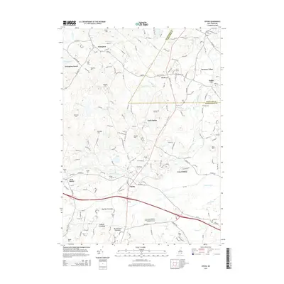
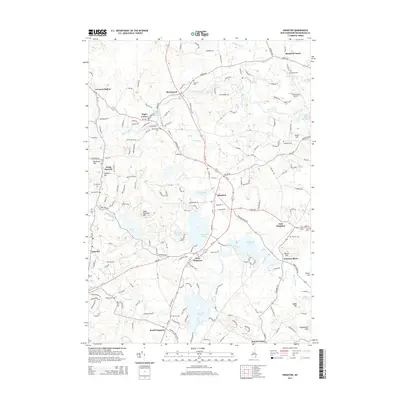
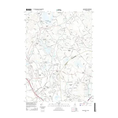
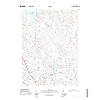
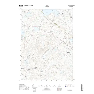
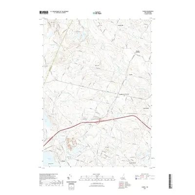
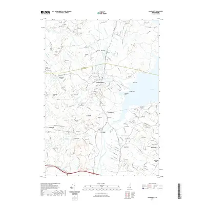
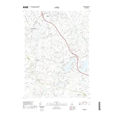
1934 Map of Exeter
USGS Topo · Published 1941About this map
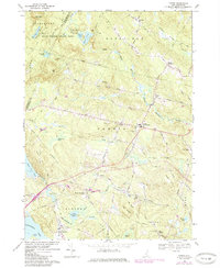
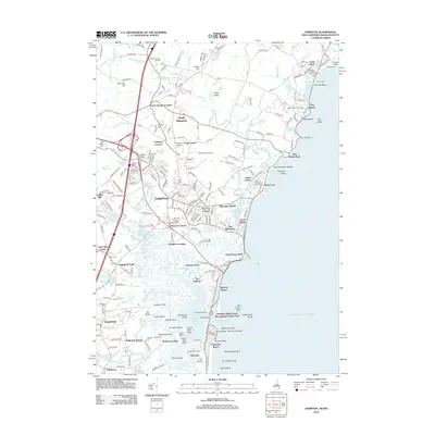
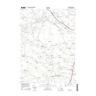
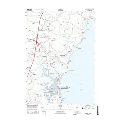
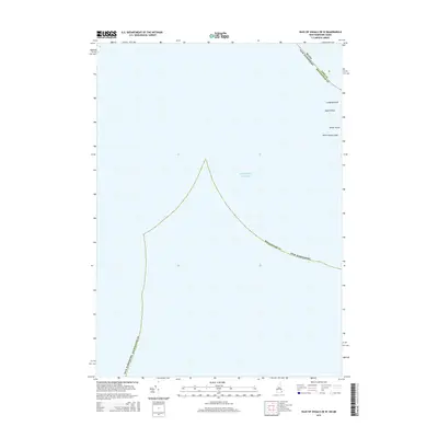
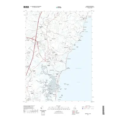
Phillips Exeter Academy anchors the inland landscape of this coastal survey, where the Exeter River winds through a network of small schoolhouses and family-named corners such as Humphrey Corners and Fogg Corners. The topography reveals the intricate water economy of the New Hampshire and Massachusetts borderlands, defined by the tidal reaches of the Hampton River and the broad mouth of the Merrimack River at Newburyport. Along the shoreline, the map details a world of maritime navigation and recreation, from the rocky outcrops of Rye Ledge to the busy stretches of Hampton Beach and the protective barrier of Plum Island. The presence of the U.S. Life Saving Station and multiple light stations like the Newburyport Light highlights the era's reliance on coastal safety infrastructure. Heavy rail corridors, including the Boston and Maine Railroad, cut through marshlands to serve stations at Seabrook Sta and Hampton Falls Sta.
Find a feature on this map
150 named features on this map. Tap any name to fly to it.
Don’t see what you’re looking for? This feature index may not catch every label — zoom into the map to look around manually.
Map Details
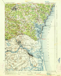
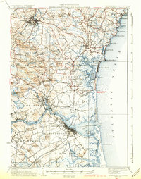
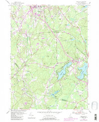
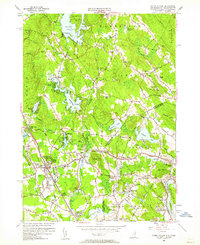
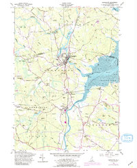
Editions of this 1934 Exeter Map
5 editions found

Historical Maps of Haverhill Through Time
99 maps found

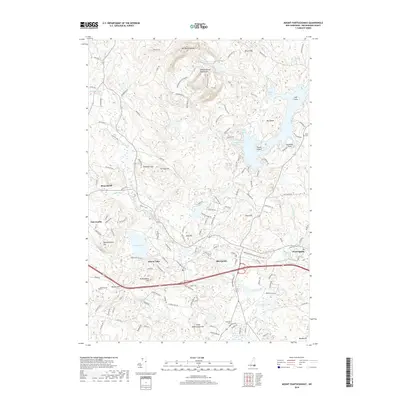
1917 Mt. Pawtuckaway
Rockingham County, NH
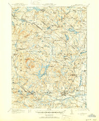
1919 Mt. Pawtuckaway
Rockingham County, NH

1932 Exeter
Rockingham County, NH

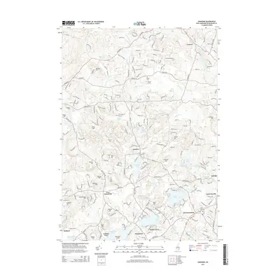
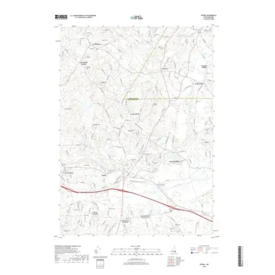
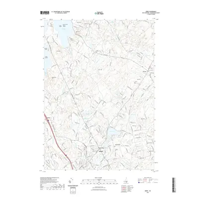
1934 Exeter
Rockingham County, NH

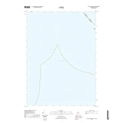
1935 Hampstead
Rockingham County, NH

1939 Mt. Pawtuckaway
Rockingham County, NH

1943 Ayers Village
Rockingham County, NH

1944 Hampton
Rockingham County, NH

1944 Mt. Pawtuckaway
Rockingham County, NH
1950 Exeter
Rockingham County, NH

1952 Ayers Village
Rockingham County, NH
1953 Windham
Rockingham County, NH
1955 Ayers Village
Rockingham County, NH
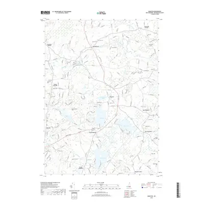
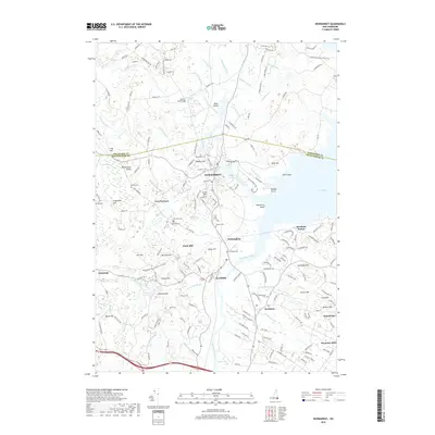
1956 Newmarket
Rockingham County, NH
1957 Hampton
Rockingham County, NH
1957 Mt. Pawtuckaway
Rockingham County, NH
1968 Derry
Rockingham County, NH
1968 Salem Depot
Rockingham County, NH
1969 Candia
Rockingham County, NH

1977 Derry
Rockingham County, NH

1977 Exeter
Rockingham County, NH

1977 Hampton
Rockingham County, NH

1977 Salem Depot
Rockingham County, NH

1977 Windham
Rockingham County, NH

1981 Epping
Rockingham County, NH
1981 Kingston
Rockingham County, NH
1981 Mt. Pawtuckaway
Rockingham County, NH
1981 Northwood
Rockingham County, NH
1981 Sandown
Rockingham County, NH

1985 Exeter
Rockingham County, NH

1987 Exeter
Rockingham County, NH

1992 Exeter
Rockingham County, NH

1995 Epping
Rockingham County, NH

1995 Northwood
Rockingham County, NH
2012 Candia
Rockingham County, NH
2012 Derry
Rockingham County, NH
2012 Epping
Rockingham County, NH
2012 Exeter
Rockingham County, NH
2012 Hampton
Rockingham County, NH
2012 Isles of Shoals OE W
Rockingham County, NH
2012 Kingston
Rockingham County, NH
2012 Mount Pawtuckaway
Rockingham County, NH
2012 Newmarket
Rockingham County, NH
2012 Northwood
Rockingham County, NH
2012 Salem Depot
Rockingham County, NH
2012 Sandown
Rockingham County, NH
2012 Windham
Rockingham County, NH
2015 Candia
Rockingham County, NH
2015 Derry
Rockingham County, NH
2015 Epping
Rockingham County, NH
2015 Exeter
Rockingham County, NH
2015 Hampton
Rockingham County, NH
2015 Isles of Shoals OE W
Rockingham County, NH
2015 Kingston
Rockingham County, NH
2015 Mount Pawtuckaway
Rockingham County, NH
2015 Newmarket
Rockingham County, NH
2015 Northwood
Rockingham County, NH
2015 Salem Depot
Rockingham County, NH
2015 Sandown
Rockingham County, NH
2015 Windham
Rockingham County, NH
2018 Candia
Rockingham County, NH
2018 Derry
Rockingham County, NH
2018 Epping
Rockingham County, NH
2018 Exeter
Rockingham County, NH
2018 Hampton
Rockingham County, NH
2018 Isles of Shoals OE W
Rockingham County, NH
2018 Kingston
Rockingham County, NH
2018 Mount Pawtuckaway
Rockingham County, NH
2018 Newmarket
Rockingham County, NH
2018 Northwood
Rockingham County, NH
2018 Salem Depot
Rockingham County, NH
2018 Sandown
Rockingham County, NH
2018 Windham
Rockingham County, NH
2021 Candia
Rockingham County, NH
2021 Derry
Rockingham County, NH
2021 Epping
Rockingham County, NH
2021 Exeter
Rockingham County, NH
2021 Hampton
Rockingham County, NH
2021 Isles of Shoals OE W
Rockingham County, NH
2021 Kingston
Rockingham County, NH
2021 Mount Pawtuckaway
Rockingham County, NH
2021 Newmarket
Rockingham County, NH
2021 Northwood
Rockingham County, NH
2021 Salem Depot
Rockingham County, NH
2021 Sandown
Rockingham County, NH
2021 Windham
Rockingham County, NH

2024 Candia
Rockingham County, NH

2024 Derry
Rockingham County, NH

2024 Epping
Rockingham County, NH

2024 Exeter
Rockingham County, NH

2024 Hampton
Rockingham County, NH

2024 Isles of Shoals OE W
Rockingham County, NH

2024 Kingston
Rockingham County, NH
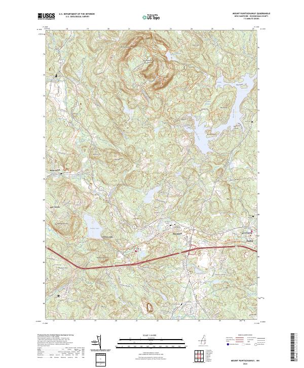
2024 Mount Pawtuckaway
Rockingham County, NH

2024 Newmarket
Rockingham County, NH

2024 Northwood
Rockingham County, NH

2024 Salem Depot
Rockingham County, NH

2024 Sandown
Rockingham County, NH
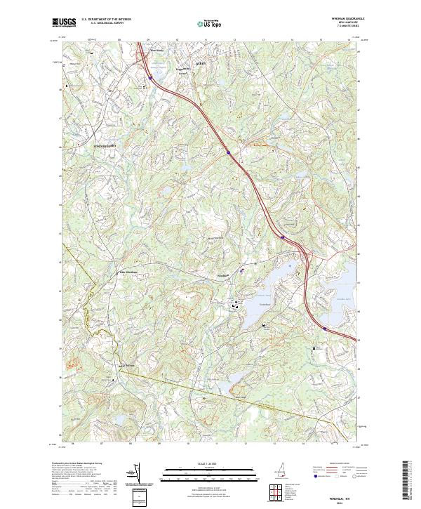
2024 Windham
Rockingham County, NH