Loading...
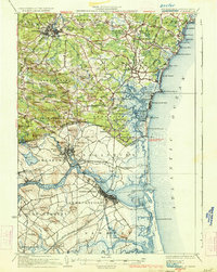
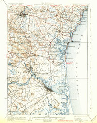
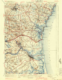
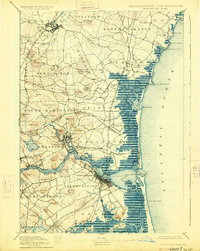
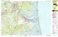
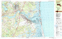
Loading map...1934 Map of Newburyport
USGS Topo · Published 1934About this map
Phillips Exeter Academy anchors the northwestern corner of this coastal landscape, situated along the upper reaches of the Exeter River. The survey depicts the Seacoast region in the early 1930s, showing a well-established network of coastal roads like Atlantic Ave connecting the seasonal resort towns of Jenness Beach, Rye Beach, and Hampton Beach. The terrain is characterized by numerous family-named landmarks such as Wolf Hills and Monday Hill, reflecting generations of land tenure across the New Hampshire and Massachusetts border.
Find a feature on this map
159 named features on this map. Tap any name to fly to it.
Don’t see what you’re looking for? This feature index may not catch every label — zoom into the map to look around manually.
Map Details
Date Portrayed1934
Date Published1934
PublisherU.S. Geological Survey
Map TypeTopographic
Scale1:62,500
Physical Dimensions15.8 x 19.8 inches
Editions of this 1934 Newburyport Map
5 editions found


Historical Maps of Haverhill Through Time
5 maps found


Featured Locations
Source Details
SourceU.S. Geological Survey
CopyrightPublic Domain