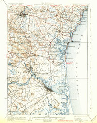
1934 Map of Newburyport
USGS Topo · Published 1934About this map
Phillips Exeter Academy and the industrial riverfront of Newburyport anchor this mid-1930s coastal survey, depicting the transition from the bustling Merrimac River shipping corridor to the tidal marshes of the Hampton River. The landscape is a mix of dense colonial-era settlements like Exeter and Newbury Old Town and more isolated seaside outposts such as Rye Beach and Seabrook Beach.
Find a feature on this map
156 named features on this map. Tap any name to fly to it.
Don’t see what you’re looking for? This feature index may not catch every label — zoom into the map to look around manually.
Map Details
Editions of this 1934 Newburyport Map
5 editions found

Other maps of this area

1886 · Gloucester
USGS Topo · 1:62,500

1886 · Lawrence
USGS Topo · 1:62,500

1888 · Newburyport
USGS Topo · 1:62,500

1888 · Haverhill
USGS Topo · 1:62,500

1888 · Gloucester
USGS Topo · 1:62,500

1888 · Lawrence
USGS Topo · 1:62,500

1888 · Salem
USGS Topo · 1:62,500

1890 · Haverhill
USGS Topo · 1:62,500

1890 · Newburyport
USGS Topo · 1:62,500

1893 · Dover
USGS Topo · 1:62,500