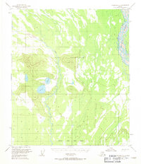
1950 Map of Fairbanks B-1
USGS Topo · Published 1971About this map
Fort Wainwright territory dominates this mid-century landscape south of the Tanana, characterized by a complex network of glacial meltwater paths and remote upland peaks. The eastern boundary is defined by the braided channels of the Tanana River, while the interior is marked by the distinct Blair Lakes cluster. A solitary Landing Strip positioned near the lakes suggests the logistical importance of this area for interior access and military operations during the early Cold War era. The terrain transitions from the low-lying reaches of Dry Creek and Mc Donald Creek to the prominent elevation at VABM Flat 1406. This survey, based on 1949 aerial photography, captures the Fairbanks North Star Borough wilderness before more intensive modern development altered the drainage patterns of these subarctic wetlands.
Find a feature on this map
8 named features on this map. Tap any name to fly to it.
Don’t see what you’re looking for? This feature index may not catch every label — zoom into the map to look around manually.
Map Details
Editions of this 1950 Fairbanks B-1 Map
4 editions found

Other maps of this area

1949 · Big Delta B-6
USGS Topo · 1:63,360

1949 · Fairbanks C-1
USGS Topo · 1:63,360

1949 · Big Delta C-6
USGS Topo · 1:63,360

1949 · Fairbanks C-2
USGS Topo · 1:63,360

1949 · Big Delta A-6
USGS Topo · 1:63,360

1949 · Fairbanks A-2
USGS Topo · 1:63,360

1949 · Fairbanks A-1
USGS Topo · 1:63,360

1950 · Fairbanks
USGS Topo · 1:250,000

1950 · Big Delta
USGS Topo · 1:250,000

1950 · Fairbanks C-1
USGS Topo · 1:63,360