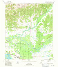
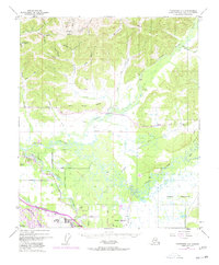
1949 Map of Fairbanks D-1
USGS Topo · Published 1971About this map
North Pole serves as a focal point for this interior Alaskan landscape, situated just north of the Tanana River and the braided waters of Chena Slough. Based on a 1949 survey, the map illustrates a region transitioning from raw wilderness to early mid-century development. The Alaska Railroad and the Alaska Highway cut through the southern portion of the sheet, providing vital transport links between the developing settlement of Highland Park and the specialized airfield at Bradley Sky Ranch.
Find a feature on this map
52 named features on this map. Tap any name to fly to it.
Don’t see what you’re looking for? This feature index may not catch every label — zoom into the map to look around manually.
Map Details
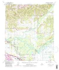
Editions of this 1949 Fairbanks D-1 Map
7 editions found
Other maps of this area

1945 · Livengood
USGS Topo · 1:250,000

1949 · Fairbanks D-1
USGS Topo · 1:62,500

1949 · Fairbanks D-2
USGS Topo · 1:62,500

1949 · Fairbanks C-1
USGS Topo · 1:63,360

1949 · Big Delta C-6
USGS Topo · 1:63,360

1949 · Fairbanks C-2
USGS Topo · 1:63,360

1950 · Fairbanks
USGS Topo · 1:250,000

1950 · Big Delta
USGS Topo · 1:250,000

1950 · Big Delta D-6
USGS Topo · 1:63,360

1950 · Fairbanks C-1
USGS Topo · 1:63,360