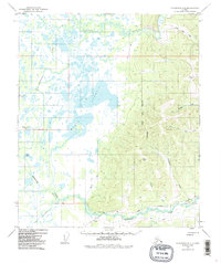
1949 Map of Fairbanks D-4
USGS Topo · Published 1986About this map
Chatanika River waters and the extensive Mint Lakes marshlands define this Interior Alaska landscape as it appeared in the mid-twentieth century. The transition from the low-lying wetland basins to the elevated terrain of the North Star Borough is punctuated by isolated human footprints, most notably an Indian Cemetery located near Goldstream Creek. The map documents a rugged transportation network where traditional winter travel routes like the Sled Road exist alongside the industrial spine of The Alaska Railroad.
Find a feature on this map
27 named features on this map. Tap any name to fly to it.
Don’t see what you’re looking for? This feature index may not catch every label — zoom into the map to look around manually.
Map Details
Editions of this 1949 Fairbanks D-4 Map
5 editions found
Other maps of this area

1945 · Livengood
USGS Topo · 1:250,000

1949 · Fairbanks D-3
USGS Topo · 1:63,360

1949 · Fairbanks D-4
USGS Topo · 1:63,360

1950 · Fairbanks
USGS Topo · 1:250,000

1950 · Fairbanks C-3
USGS Topo · 1:63,360

1950 · Fairbanks C-5
USGS Topo · 1:63,360

1950 · Fairbanks C-4
USGS Topo · 1:63,360

1950 · Fairbanks D-5
USGS Topo · 1:63,360

1950 · Fairbanks D-3
USGS Topo · 1:63,360

1951 · Fairbanks
USGS Topo · 1:250,000