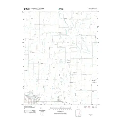
2012 Map of Fairfield
USGS Topo · Published 2012About this map
Fairfield serves as the focal point of this Wayne County landscape, situated where the terrain transitions into a complex network of agricultural drainage. The southeastern corner of the city is marked by several burial grounds, including Maple Hill Cem, Shaeffer Cem, and Curry Cem, while the Old Fairfield Reservoir lies just to the north. These features, along with the Po downtown, define the civic center of the region during the early 21st century.
Find a feature on this map
101 named features on this map. Tap any name to fly to it.
Don’t see what you’re looking for? This feature index may not catch every label — zoom into the map to look around manually.
Map Details
Editions of this 2012 Fairfield Map
This is the sole edition of this map. No revisions or reprints were ever made.
Other maps of this area

1943 · Albion
USGS Topo · 1:62,500

1946 · Albion
USGS Topo · 1:62,500

1948 · Fairfield
USGS Topo · 1:62,500

1948 · Flora
USGS Topo · 1:62,500

1949 · Olney
USGS Topo · 1:62,500

1949 · Flora
USGS Topo · 1:62,500

1958 · Belleville
USGS Topo · 1:250,000

1962 · Belleville
USGS Topo · 1:250,000

1970 · Enterprise
USGS Topo · 1:24,000
1970 · Cisne
USGS Topo · 1:24,000