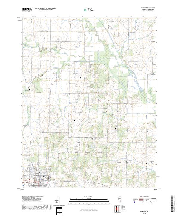
2024 Map of Fairfield
USGS Topo · Published 2024About this map
Fairfield serves as the regional hub on this map, anchored by the Wayne County Courthouse and a dense network of local cemeteries including Maple Hill Cem and Slocumb Cem. The surrounding rural landscape is defined by its sophisticated drainage network, where natural watercourses like the Elm River and Deer Creek are augmented by the Elm River Drainage Ditch and Little Elm Lateral. This system of ditches and laterals reflects a long history of water management to support agricultural productivity in the flat lowlands of the region.
Find a feature on this map
86 named features on this map. Tap any name to fly to it.
Don’t see what you’re looking for? This feature index may not catch every label — zoom into the map to look around manually.
Map Details
Editions of this 2024 Fairfield Map
This is the sole edition of this map. No revisions or reprints were ever made.
Other maps of this area

1943 · Albion
USGS Topo · 1:62,500

1946 · Albion
USGS Topo · 1:62,500

1948 · Fairfield
USGS Topo · 1:62,500

1948 · Flora
USGS Topo · 1:62,500

1949 · Olney
USGS Topo · 1:62,500

1949 · Flora
USGS Topo · 1:62,500

1958 · Belleville
USGS Topo · 1:250,000

1962 · Belleville
USGS Topo · 1:250,000

1970 · Enterprise
USGS Topo · 1:24,000
1970 · Cisne
USGS Topo · 1:24,000