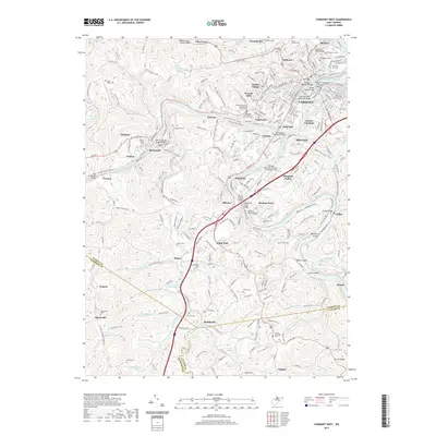
2019 Map of Fairmont West
USGS Topo · Published 2019About this map
Fairmont sits at the confluence of the West Fork River and the Tygart Valley River, where they join to form the northward-flowing Monongahela River. This modern survey reveals a landscape deeply connected by its waterway crossings, including the Million Dollar Bridge and the David Morgan Memorial Bridge. The density of cemeteries, such as Woodlawn Cem and Fairmont City Cem, reflects a century of settlement and genealogy across the hills of Marion, Harrison, and Taylor counties. Smaller communities like Monongah, Bentons Ferry, and Kingmont are linked by winding roads and the Across-Town Trails Line. The map also captures local industrial and civic infrastructure, from Gaston Junction to the Fairmont Municipal Airport-Frankman Field, illustrating how the valley's steep topography continues to dictate the patterns of transit and habitation.
Find a feature on this map
267 named features on this map. Tap any name to fly to it.
Don’t see what you’re looking for? This feature index may not catch every label — zoom into the map to look around manually.
Map Details
Editions of this 2019 Fairmont West Map
This is the sole edition of this map. No revisions or reprints were ever made.
Other maps of this area

1902 · Clarksburg
USGS Topo · 1:62,500

1902 · Fairmont
USGS Topo · 1:62,500

1904 · Blacksville
USGS Topo · 1:62,500

1905 · Mannington
USGS Topo · 1:62,500

1910 · Clarksburg
USGS Topo · 1:62,500

1923 · Blacksville
USGS Topo · 1:62,500

1923 · Fairmont
USGS Topo · 1:62,500

1923 · Mannington
USGS Topo · 1:62,500

1923 · Clarksburg
USGS Topo · 1:62,500

1925 · Blacksville
USGS Topo · 1:62,500