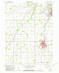
1960 Map of Fairmount
USGS Topo · Published 1982About this map
Fairmount and Jonesboro anchor this Indiana landscape, where the agricultural grid is defined by a dense network of drainage ditches and winding creeks. The map documents the mid-century infrastructure of southern Grant County, showing the intersection of the Conrail and Chesapeake And Ohio railroads alongside the Marion Municipal Airport. Small rural settlements like Weaver, Radley, and Hackleman are visible, each serving as local centers for the surrounding farming community.
Find a feature on this map
38 named features on this map. Tap any name to fly to it.
Don’t see what you’re looking for? This feature index may not catch every label — zoom into the map to look around manually.
Map Details
Editions of this 1960 Fairmount Map
Other maps of this area

1953 · Muncie
USGS Topo · 1:250,000

1956 · Muncie
USGS Topo · 1:250,000

1960 · Elwood
USGS Topo · 1:24,000

1960 · Point Isabel
USGS Topo · 1:24,000

1960 · Alexandria
USGS Topo · 1:24,000

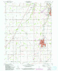
1960 · Fairmount
USGS Topo · 1:24,000

1960 · Gas City
USGS Topo · 1:24,000

1960 · Gaston
USGS Topo · 1:24,000

1961 · Marion
USGS Topo · 1:24,000
1962 · Sweetser
USGS Topo · 1:24,000