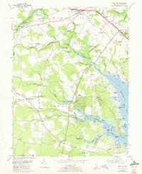
1954 Map of Fairmount
USGS Topo · Published 1972About this map
The agricultural landscape of Sussex County meets the tidal inlets of Rehoboth Bay in this mid-century look at coastal Delaware. Small rural settlements like Jimtown, Pinetown, and Robinsonville anchor the inland districts, while social hubs like Cool Spring Grange and Angola Grange speak to the region's farming heritage. The map documents a time when community life centered on landmarks like St Georges Ch, Indian Mission Ch, and local schoolhouses such as Rabbits Ferry Sch.
Find a feature on this map
95 named features on this map. Tap any name to fly to it.
Don’t see what you’re looking for? This feature index may not catch every label — zoom into the map to look around manually.
Map Details
Editions of this 1954 Fairmount Map
3 editions found
Other maps of this area

1917 · Millsboro
USGS Topo · 1:62,500

1918 · Cedar Creek
USGS Topo · 1:62,500

1918 · Rehoboth
USGS Topo · 1:62,500

1918 · Cape Henlopen
USGS Topo · 1:62,500

1919 · Cedar Creek
USGS Topo · 1:62,500

1937 · Cape Henlopen
USGS Topo · 1:62,500

1938 · Cedar Creek
USGS Topo · 1:62,500

1938 · Millsboro
USGS Topo · 1:62,500

1938 · Rehoboth
USGS Topo · 1:62,500

1943 · Fairmount
USGS Topo · 1:24,000
Featured Places
- Angola Crest Mobile Home Park, DE
- Angola Landing, DE
- Cool Spring, DE
- William Ritter Manor, DE
- Mallard Point, DE