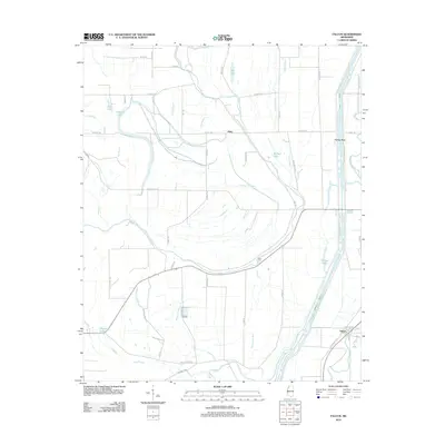
2012 Map of Falcon
USGS Topo · Published 2012About this map
Falcon and Tibbs anchor this section of the Mississippi Delta, where a dense network of bayous and drainage ditches defines the agricultural landscape. The Coldwater River meanders across the center of the sheet, guarded by the Coldwater River Levee and historically crossed at Neels Ferry. This area is characterized by its numerous oxbow remnants and wetlands, including Reel Lake, Sixmile Lake, and McNeil Lake, which speak to the river's historical shifts before modern water management. Genealogists and local researchers can trace family-named roads like Graveyard Rd and Rayford Rd, alongside industrial markers like Railroad Ave in Falcon. The complex hydrology is further evidenced by engineered features such as Pompey Ditch and natural drainages like Twelvemile Bayou and Sunrise Bayou, illustrating the ongoing effort to manage the fertile but low-lying terrain of Quitman County.
Find a feature on this map
57 named features on this map. Tap any name to fly to it.
Don’t see what you’re looking for? This feature index may not catch every label — zoom into the map to look around manually.
Map Details
Editions of this 2012 Falcon Map
This is the sole edition of this map. No revisions or reprints were ever made.
Other maps of this area

1908 · Lula
USGS Topo · 1:24,000

1908 · Dundee
USGS Topo · 1:24,000

1908 · Jonestown
USGS Topo · 1:24,000

1908 · Walnut Lake
USGS Topo · 1:24,000

1910 · Dundee
USGS Topo · 1:31,680

1910 · Walnut Lake
USGS Topo · 1:31,680

1910 · Jonestown
USGS Topo · 1:31,680

1912 · Lula
USGS Topo · 1:31,680

1932 · Sledge
USGS Topo · 1:48,000

1932 · Marks
USGS Topo · 1:48,000