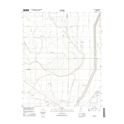
2015 Map of Falcon
USGS Topo · Published 2015About this map
The Coldwater River meanders across this alluvial landscape on the Tunica Co and Quitman Co line, defining a region where water management is central to the terrain. This drainage network is characterized by numerous bayous and ditches, such as Twelvemile Bayou and Pompey Ditch, which redirect water around the scattered settlements of Falcon and Tibbs. The map reveals the intricate relationship between the river's path and local land use, with family-named roads like Tibbs Rd and Mayo Rd providing access to the fertile grounds surrounding Fish Lake and McNeil Lake. These water bodies and slow-moving bayous, including Graveyard Bayou and Thomasson Bayou, suggest a long-standing pattern of agricultural development in this corner of the Mississippi Delta.
Find a feature on this map
56 named features on this map. Tap any name to fly to it.
Don’t see what you’re looking for? This feature index may not catch every label — zoom into the map to look around manually.
Map Details
Editions of this 2015 Falcon Map
This is the sole edition of this map. No revisions or reprints were ever made.
Other maps of this area

1908 · Lula
USGS Topo · 1:24,000

1908 · Dundee
USGS Topo · 1:24,000

1908 · Jonestown
USGS Topo · 1:24,000

1908 · Walnut Lake
USGS Topo · 1:24,000

1910 · Dundee
USGS Topo · 1:31,680

1910 · Walnut Lake
USGS Topo · 1:31,680

1910 · Jonestown
USGS Topo · 1:31,680

1912 · Lula
USGS Topo · 1:31,680

1932 · Sledge
USGS Topo · 1:48,000

1932 · Marks
USGS Topo · 1:48,000