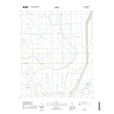
2020 Map of Falcon
USGS Topo · Published 2020About this map
The Coldwater River dominates this Delta landscape as it winds through the alluvial plains of the Tunica and Quitman County border. This modern survey illustrates the critical infrastructure of the region, specifically the massive Cold Water River Levee that protects the surrounding lowlands from seasonal flooding. The map reveals a complex hydrographic network where natural oxbows and drainages like Mussel Lake, Hornet Lake, and Graveyard Bayou exist alongside engineered water management features such as Pompey Ditch. The settlement patterns here are modest, anchored by the community of Falcon and the smaller locality of Tibbs, with a geometric grid of rural roads like Six Mile Lake Rd and Cotton Loop Rd defining the agricultural sections. This document captures the intersection of traditional river geography and modern levee systems within one of Mississippi's most productive farming regions.
Find a feature on this map
60 named features on this map. Tap any name to fly to it.
Don’t see what you’re looking for? This feature index may not catch every label — zoom into the map to look around manually.
Map Details
Editions of this 2020 Falcon Map
This is the sole edition of this map. No revisions or reprints were ever made.
Other maps of this area

1908 · Lula
USGS Topo · 1:24,000

1908 · Dundee
USGS Topo · 1:24,000

1908 · Jonestown
USGS Topo · 1:24,000

1908 · Walnut Lake
USGS Topo · 1:24,000

1910 · Dundee
USGS Topo · 1:31,680

1910 · Walnut Lake
USGS Topo · 1:31,680

1910 · Jonestown
USGS Topo · 1:31,680

1912 · Lula
USGS Topo · 1:31,680

1932 · Sledge
USGS Topo · 1:48,000

1932 · Marks
USGS Topo · 1:48,000