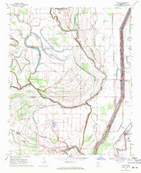
1969 Map of Falcon
USGS Topo · Published 1971About this map
The Coldwater River snakes through this Mississippi Delta landscape, defining the borders of Tunica Co and Quitman Co. The 1969 landscape is a complex network of oxbows and bayous, including Sunrise Lake, Sixmile Lake, and McNeil Lake, illustrating the river's historical shifts. A prominent line on the land is the Old Indian Treaty Boundary, which cuts across the terrain south of the river, marking an important historical partition. In the southeast corner, the settlement of Falcon serves as a hub on the Illinois Central railroad.
Find a feature on this map
40 named features on this map. Tap any name to fly to it.
Don’t see what you’re looking for? This feature index may not catch every label — zoom into the map to look around manually.
Map Details
Editions of this 1969 Falcon Map
This is the sole edition of this map. No revisions or reprints were ever made.
Other maps of this area

1908 · Lula
USGS Topo · 1:24,000

1908 · Dundee
USGS Topo · 1:24,000

1908 · Jonestown
USGS Topo · 1:24,000

1908 · Walnut Lake
USGS Topo · 1:24,000

1910 · Dundee
USGS Topo · 1:31,680

1910 · Walnut Lake
USGS Topo · 1:31,680

1910 · Jonestown
USGS Topo · 1:31,680

1912 · Lula
USGS Topo · 1:31,680

1932 · Sledge
USGS Topo · 1:48,000

1932 · Marks
USGS Topo · 1:48,000