
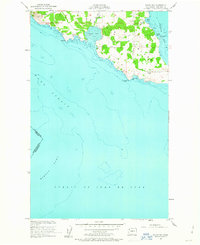
1954 Map of False Bay
USGS Topo · Published 1957About this map
San Juan Island meets the sea at the southern reaches of the archipelago, where the vast Haro Strait and Strait of Juan de Fuca converge. The landscape is defined by its maritime exposure, featuring prominent coastal landmarks like Pile Pt and Eagle Pt. On the eastern shore, the waters of Griffin Bay provide a more sheltered contrast to the open straits. This mid-century survey captures the island before significant modern development, showing the winding routes of West Side Road and Cattle Point Road.
Find a feature on this map
19 named features on this map. Tap any name to fly to it.
Don’t see what you’re looking for? This feature index may not catch every label — zoom into the map to look around manually.
Map Details
Editions of this 1954 False Bay Map
Other maps of this area

1943 · Richardson
USGS Topo · 1:62,500

1943 · Orcas Island
USGS Topo · 1:62,500

1954 · Roche Harbor
USGS Topo · 1:24,000

1954 · Friday Harbor
USGS Topo · 1:24,000

1957 · Richardson
USGS Topo · 1:62,500

1957 · Orcas Island
USGS Topo · 1:62,500

1957 · Victoria
USGS Topo · 1:250,000

1973 · Shaw Island
USGS Topo · 1:24,000

1975 · Bellingham
USGS Topo · 1:100,000
1975 · Port Townsend
USGS Topo · 1:100,000