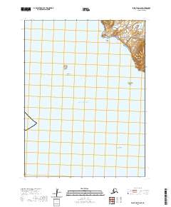
2020 Map of False Pass D-2 SE
USGS Topo · Published 2020About this map
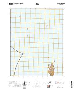
Paw Cape and the surrounding coastline of the Pacific Ocean define this maritime landscape in the Aleutians East Borough. The terrain is dominated by offshore landmarks and coastal indentations, with Bent Cove providing a sheltered pocket near the northern edge of the survey. The shoreline is punctuated by several small islands and hazards, including Let Island, Fawn Island, and the isolated Bun Rock. Further south, Mean Rock sits in the open water, serving as a vital navigational marker for the area. Drainage from the mainland is primarily represented by Southern Cr, which flows toward the eastern coast. This survey illustrates the sparse, island-dotted nature of the coastal Aleutians, where named rocks and capes are the primary features of the nautical environment.
Find a feature on this map
14 named features on this map. Tap any name to fly to it.
Don’t see what you’re looking for? This feature index may not catch every label — zoom into the map to look around manually.
Map Details
Editions of this 2020 False Pass D-2 SE Map
This is the sole edition of this map. No revisions or reprints were ever made.
Other maps of this area

1949 · False Pass
USGS Topo · 1:250,000

1950 · False Pass
USGS Topo · 1:250,000
1963 · False Pass C-2
USGS Topo · 1:63,360

1963 · False Pass D-1
USGS Topo · 1:63,360

1963 · False Pass D-2
USGS Topo · 1:63,360
1963 · False Pass C-1
USGS Topo · 1:63,360
2020 · False Pass C-1 NW
USGS Topo · 1:25,000
2020 · False Pass C-2 NE
USGS Topo · 1:25,000
2020 · False Pass D-1 NW
USGS Topo · 1:25,000
2020 · False Pass D-2 NE
USGS Topo · 1:25,000