
1959 Map of Fargo North
USGS Topo · Published 1960About this map
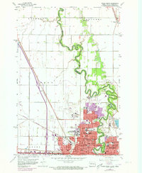
The Red River of the North winds sharply between North Dakota and Minnesota, separating the growing urban centers of Fargo and Moorhead. This late-1950s landscape shows the intensive development of the North Dakota Agriculture College and the expanding Hector Field airport facilities. While the city grid pushes northward with numerous institutions like Sacred Heart Academy and Holy Spirit Sch, the surrounding townships of Reed and Kragnes remain largely agricultural. Significant infrastructure includes the Great Northern and Northern Pacific rail lines, which intersect near the heart of the city. Notable local landmarks like the State Fairground and St Lukes Hospital anchor the community, while the river banks are dotted with legacy sites such as the County Farm and Fridhem Cem.
Find a feature on this map
60 named features on this map. Tap any name to fly to it.
Don’t see what you’re looking for? This feature index may not catch every label — zoom into the map to look around manually.
Map Details
Editions of this 1959 Fargo North Map
4 editions found
Other maps of this area

1895 · Fargo
USGS Topo · 1:125,000

1897 · Fargo
USGS Topo · 1:125,000

1952 · Grand Forks
USGS Topo · 1:250,000

1953 · Fargo
USGS Topo · 1:250,000

1956 · Fargo
USGS Topo · 1:250,000

1956 · Grand Forks
USGS Topo · 1:250,000

1959 · South West Fargo
USGS Topo · 1:24,000

1959 · Fargo South
USGS Topo · 1:24,000

1959 · West Fargo
USGS Topo · 1:24,000

1963 · Georgetown
USGS Topo · 1:24,000