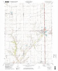
1979 Map of Farmersville
USGS Topo · Published 1980About this map
Farmersville and Waggoner anchor this late-1970s landscape, illustrating the essential connection between agriculture and industry in central Illinois. The map captures a period where coal extraction and rail transport remained vital to the local economy, as evidenced by the large footprints of Crown Mine No 2 and Crown Mine No 1 situated along the Illinois Central Gulf railroad line. The presence of the Burlington Northern railroad in the western sections further emphasizes the region's importance as a transportation corridor.
Find a feature on this map
24 named features on this map. Tap any name to fly to it.
Don’t see what you’re looking for? This feature index may not catch every label — zoom into the map to look around manually.
Map Details
Editions of this 1979 Farmersville Map
2 editions found
Other maps of this area

1922 · Divernon
USGS Topo · 1:62,500

1923 · Carlinville
USGS Topo · 1:48,000

1923 · Raymond
USGS Topo · 1:62,500

1924 · Divernon
USGS Topo · 1:62,500

1924 · Waverly
USGS Topo · 1:62,500

1925 · Carlinville
USGS Topo · 1:62,500

1925 · Raymond
USGS Topo · 1:62,500

1926 · Waverly
USGS Topo · 1:62,500

1931 · Carlinville
USGS Topo · 1:62,500

1958 · Decatur
USGS Topo · 1:250,000