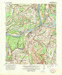
1939 Map of Farrell
USGS Topo · Published 1951About this map
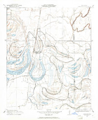
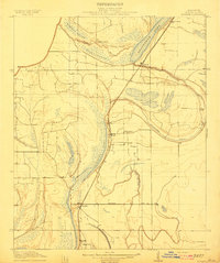
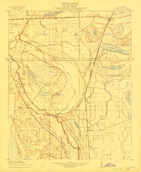
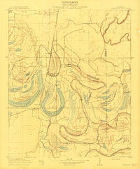
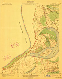
Friar Point sits at the center of this 1930s landscape, positioned near a dramatic bend in the Mississippi River. The map captures the delta just as major river engineering was reshaping its course, specifically at the Montezuma Bend Cut-Off and Old Town Bend Horseshoe Cut-Off 1848. These alterations reflect the intensive flood control efforts of the era, which protected the dense network of agricultural settlements and plantations such as Preston Place, Elkhorn Place, and King & Andersons. The river's influence is evident in the numerous oxbows and brakes, including Moon Lake and Alligator Lake. Transportation and community life were anchored by the Illinois Central and Memphis & Vicksburg railroads, which connected rural centers like Farrell and Stovall. The map is particularly rich in genealogical detail, noting dozens of country schools and churches like Little Zion Ch and Paradise Ch & Sch that served these dispersed farming communities.
Find a feature on this map
97 named features on this map. Tap any name to fly to it.
Don’t see what you’re looking for? This feature index may not catch every label — zoom into the map to look around manually.
Map Details
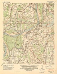
Editions of this 1939 Farrell Map
2 editions found
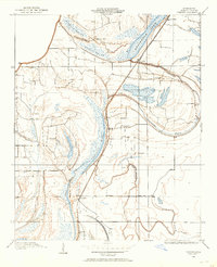
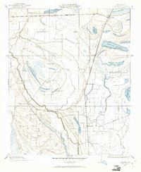
Other maps of this area

1908 · Lula
USGS Topo · 1:24,000
1908 · Dundee
USGS Topo · 1:24,000
1908 · Coahoma
USGS Topo · 1:24,000

1908 · Moon Lake
USGS Topo · 1:24,000
1908 · Jonestown
USGS Topo · 1:24,000
1910 · Dundee
USGS Topo · 1:31,680
1910 · Coahoma
USGS Topo · 1:31,680
1910 · Jonestown
USGS Topo · 1:31,680
1912 · Moon Lake
USGS Topo · 1:31,680
1912 · Lula
USGS Topo · 1:31,680