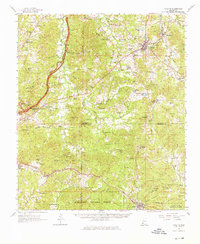
1962 Map of Fayette
USGS Topo · Published 1976About this map
The Illinois Central railroad corridor anchors this mid-century view of Jefferson and Franklin Counties, connecting the town of Fayette to the junction at Harriston. The landscape is a mix of agricultural lowlands and timbered ridges, with the sprawling Homochitto National Forest occupying the southern reaches. Cultural sites are densely scattered throughout, from the historic Emerald Mound near Stanton to numerous family cemeteries such as Folkes Cem and Whitens Cem.
Find a feature on this map
118 named features on this map. Tap any name to fly to it.
Don’t see what you’re looking for? This feature index may not catch every label — zoom into the map to look around manually.
Map Details
Editions of this 1962 Fayette Map
2 editions found

Other maps of this area

1921 · Natchez
USGS Topo · 1:48,000

1922 · Natchez
USGS Topo · 1:62,500

1939 · Lorman
USGS Topo · 1:62,500

1939 · Natchez
USGS Topo · 1:62,500

1939 · Kingston
USGS Topo · 1:62,500

1939 · Locust Ridge
USGS Topo · 1:62,500

1953 · Natchez
USGS Topo · 1:250,000

1956 · Natchez
USGS Topo · 1:250,000

1958 · St. Joseph
USGS Topo · 1:62,500

1958 · Kingston
USGS Topo · 1:62,500